
Bringing Data, Science, and Technology Together
See the air with Shair
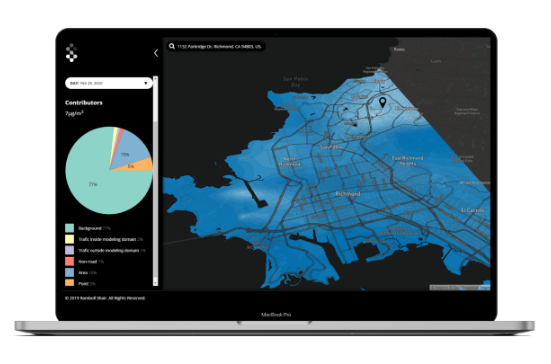
Shair tech
Shair Tech is the contextual layer to the Shair Map, to support decision-makers as they develop pollution strategies. By going into the map to answer why the air quality is what it is with features like historical data averaging, comparison mode, and source apportionment, decision-makers are able to see patterns and identify pollution-mitigation strategies with the greatest impact.
Shair Tech gets communities on the path to doing something about the air by giving them data and a visual layer that enables identification of strategy.
Get in touch with us if you are interested in launching Shair Tech in your region.
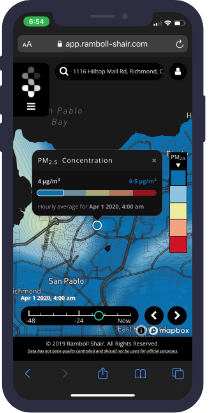
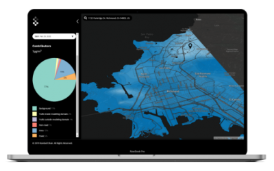
Shair map
Shair Map is the primary visual layer of the model. With 10-meter resolution, the community is able to see pollutant concentrations on a block-to-block basis – visualizing the air where they live, work, and learn. With real-time updates, historical and forecast data, community members can make better decisions all the time to protect their health, and advocate for change. This Map empowers communities to understand the environment around them.
 How Shair works
 How Shair works
The Science
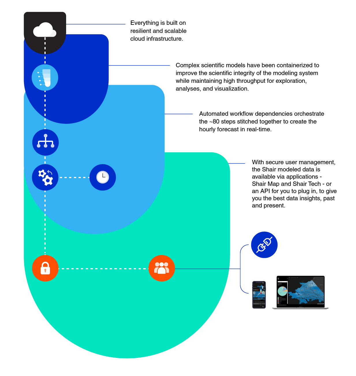
At Shair, we prioritize data quality by using validated scientific models to build our air quality tools. We make this science real-time and visualize it in an easy-to-understand map, creating a new role for regulatory science in community air quality strategies.
Under Shair’s visual layers, our model combines the peer-reviewed regional photochemical model, CAMx, with a highly efficient street-level dispersion model, Shairstreet, that enables an unprecedented 10-meter resolution while conserving mass when fusing the two models together. We combine static data sets like emissions inventories with real-time weather forecasts (computed with the WRF model) and traffic data. After the models automatically run every hour, the Shairsense layer incorporates real-time measurement data from air quality monitoring stations and sensors.

The Technology
As scientists, we wanted to strengthen our science and make it more accessible. Local-scale modelling, at ever-increasing model resolution, can strain computational, data, and analytical resources in traditional computing environments.
Powering our model with on-demand cloud computing, geospatial-aware databases, the novel fusion of regional air quality and street-level models, and contemporary web-based mapping and analytics tools can help enable a modern decision support system – with the ability to be efficient, accessible, real-time, flexible to use and remotely available. As a cloud-native platform, we have built in the benefits of the flexible technology into our science by containerizing complex scientific models into automated workflows that streamline the modelling process in a cost-effective manner. Our automated workflows enable hourly updates that run continuously without intervention and lend themselves to scientific research through modular, easy-to-read steps.
Want more details?
The Shair whitepaper offers a detailed look into what we offer and our modeling methodology.
Request the whitepaper by following the link, below.
Clear thinking – our blogs
 Clear
Clear 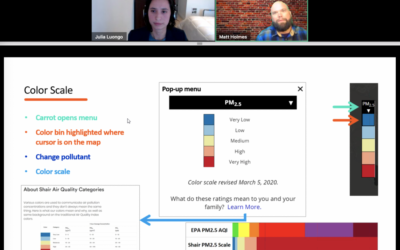
How does the Shair App work? A walkthrough of the Shair Map.
I sat down with Matt Holmes from Little Manila Rising for a webinar on February 17, 2021 describing the many features and...
Shair Published in GovTech – Users Can See San Francisco Air Quality in Real Time
https://www.govtech.com/health/Users-Can-See-San-Francisco-Air-Quality-in-Real-Time.htmlGovTech interviewed our founder, Julia Luongo, about the launch of our map in the SF Bay Area up to Sacramento - read to learn...
Shair Published in American City & County – Putting Clean Air in the hands of Municipal Leaders
Cities, counties, and communities are seeing their responsibilities expand in the pandemic public health emergency, and that...