
Work Together to Clear the Air

Bringing together everyone who lives and breathes air quality
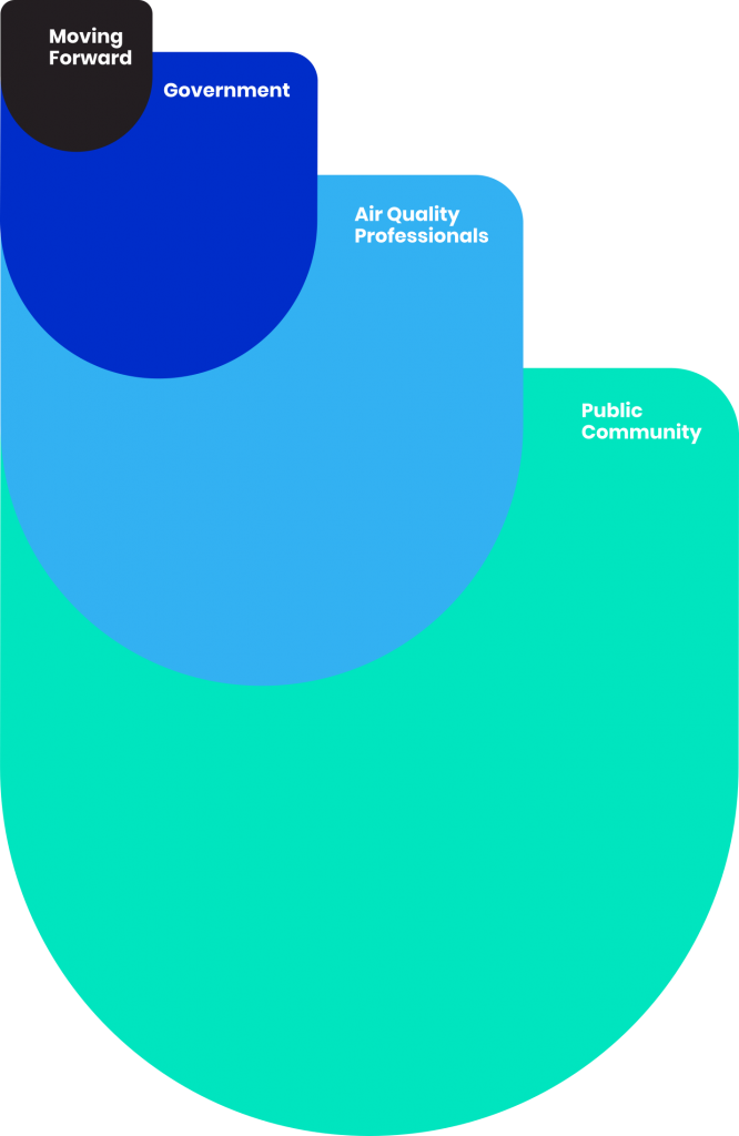
Moving Forward
Government
As awareness of the public health impacts of localized pollution grows among communties, local governments are being called to do more about the air in their communities. These governments often respond by incorporating air pollution into climate resilience planning, because the same sources of greenhouse gas emissions often produce air pollution. However, air quality management techniques have not traditionally been accessible to local government, making it difficult for governments to develop a strategy without seeing the air they are trying to change.
Shair makes the science and techniques of air quality management accessible through an easy-to-use platform. By making the air visible, government can identify land-use, traffic, and clean air zone policies that can improve the air, and measure their effectiveness – being more responsive and transparent to constituent needs with sustainability planning.
Uses
- Be open and transparent in communication about air quality across your jurisdiction
- Align stakeholders around pollution strategies
- Identify local policies that can be implemented to change the air
- Rely on the science behind regulatory air quality models
- Drive tangible improvements on sustainability metrics
Benefits
- Responsive governance to constituent concerns
- Meet sustainability metrics
- Facilitate a conversation with facts and data
- Quantify effectiveness and progress of mitigation strategies
Air Quality Professionals
Shair is streamlining and modernizing the air quality management scientific workflow. Our technology enables scientists to iteratively solve scientific problems with greater efficiency and ease to answer the next scientific question. By using on-demand cloud computing, Shair reduces capital costs associated with increased computational throughput and enables rapid computation and iteration for either historical, nowcast, or forecast modeling systems.
Shair also provides an easy mechanism for explaining the air to a non-technical audience. Help community members and local government officials understand the variability of the air through a simple visual lens, and be a trusted advisor in defining next steps, with data and technology you can trust.
Uses
- Streamline the modelling workflow
- Source apportionment at a local scale
- Increased visibility and understanding of the emissions inventory assumptions through real-time implementation
Benefits
- Increase efficiency and throughput
- Drill down into local planning and policymaking
- Expand scope of projects
Public Community
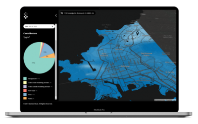
Communities are motivated to build a more sustainable future with public health at the center – but fixing a problem like air pollution is difficult without being able to see. Air quality sensors enable some visibility, but discrete measurement points cannot indicate where pollution actually is, and who it is affecting – only what is happening in that exact location. Shair brings measurement data into a model that adds the context of where air pollution is, as well as source contributing. Our mapping application, backed by modeling science that governments and regulation agencies rely on to make decisions today, help anyone understand the air quality landscape.
Use this information to understand and reduce exposure, as well as advocate for change on a shared platform.
Uses
- Plan with hourly updates and daily forecasts
- Understand recent patterns
- Understand hotspots and locations to focus on
Benefits
- See the air
- Reduce exposure
- Enable a safe future through evidence-based advocacy
Our partners
Groundwork Richmond
City of Richmond

Clarity
Purple Air
Making the air visible in Richmond, California
California Air Resources Board
California Climate Investments
 Clear thinking – our blogs
 Clear thinking – our blogs
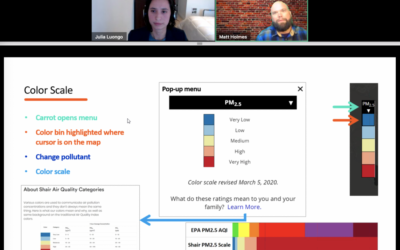
How does the Shair App work? A walkthrough of the Shair Map.
I sat down with Matt Holmes from Little Manila Rising for a webinar on February 17, 2021 describing the many features and...
Shair Published in GovTech – Users Can See San Francisco Air Quality in Real Time
https://www.govtech.com/health/Users-Can-See-San-Francisco-Air-Quality-in-Real-Time.htmlGovTech interviewed our founder, Julia Luongo, about the launch of our map in the SF Bay Area up to Sacramento - read to learn...
Shair Published in American City & County – Putting Clean Air in the hands of Municipal Leaders
Cities, counties, and communities are seeing their responsibilities expand in the pandemic public health emergency, and that...